IPhone LogoIPad LogoLight Logo
  • Home
  • Blog
  • About
  • Contact
Central America Guatemala
by flightlesskiwi

Grey skies over Antigua

15th May 2017
1
0
Share

Antigua, much like Oaxaca became a place that kept drawing us back like a magnet.

Partly because we were awaiting respectable weather for climbing the nearby volcanic peak of Acatenango. Mostly because there was a lot of really tasty food.

Antigua is a colonial city (the former capital of Guatemala) built in the shadow of several volcanoes.

The enormous Volcán de Agua towers above the city’s streets, the nearby peaks of Acatenango and Fuego were prominent features in the surrounding mountain range. The sight of constantly grumbling Volcán Fuego, spewing out lava and smoke from the city’s streets is one of the most spectacular sights to see.

Or at least that’s what we were told.

pb220510
Cobbled streets on a rainy afternoon.

The cloudy skies made it challenging to confirm these rumours. We had spent the best part of two months in and around Antigua, and had seen nothing to substantiate these claims.

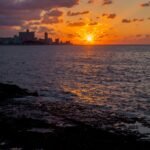
We had observed a range of cloud types though. From towering ‘cumulonimbus’, to dense ‘stratus’ and fluffy white ‘cirronimbu-no-volcanoes-for-you-strato-haze’. We had seen a lot of things in the skies above that were not volcanoes.

Grey skies and colonial rooftops.

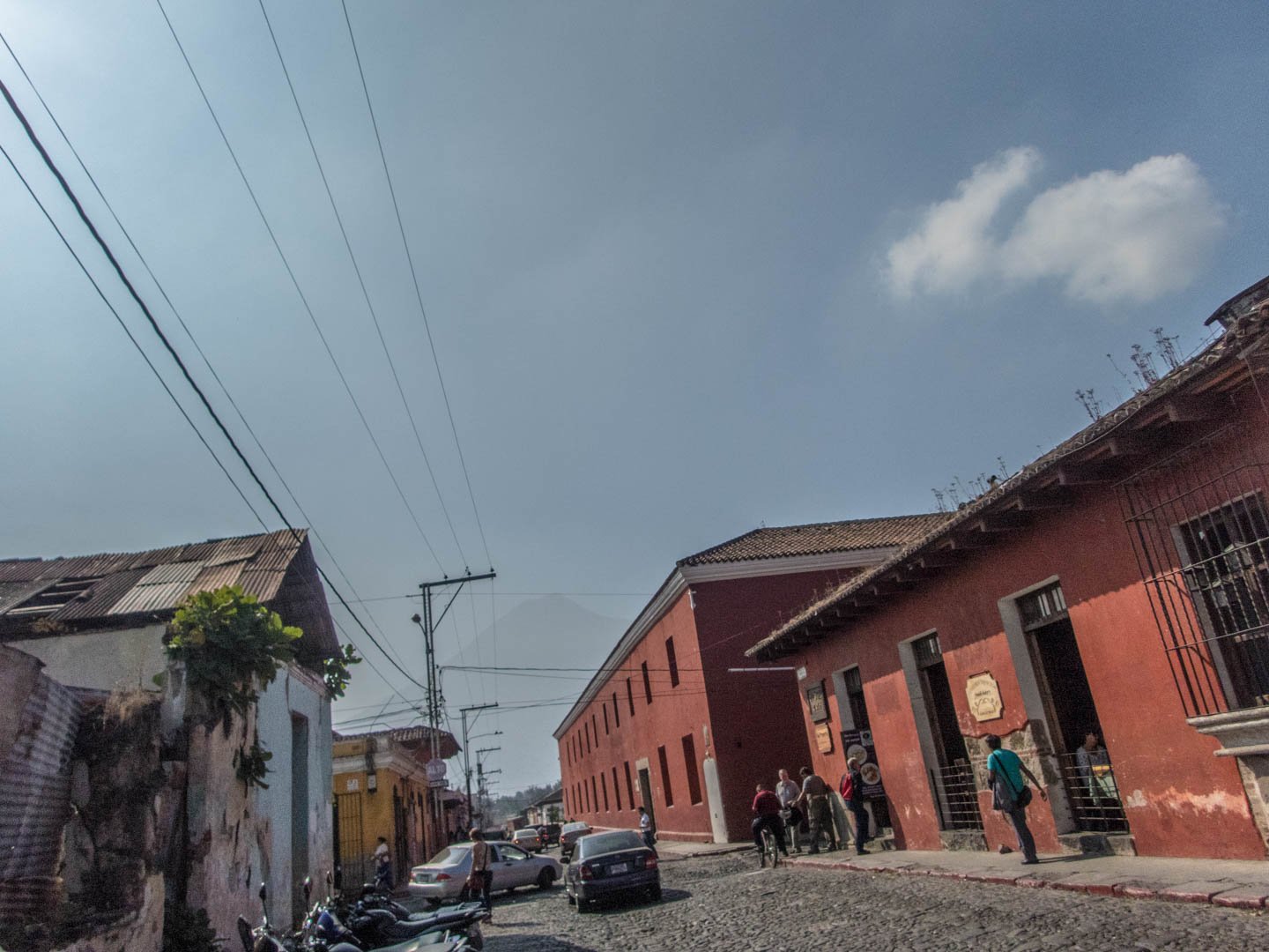
For much of our time in the town, the skies were a mournful shade of grey. Luckily, the streets of Antigua were anything but.

Antigua is a tapestry of vibrant colour. Vendors lined the streets selling all kinds of bright fabric creations.

Everywhere we looked there were vibrant, colourful vistas. There was often so much happening that we would completely forget that we were meant to be seeing volcanoes.

Sometimes the clouds would clear and we’d see patches of bright blue skies above. The sunlight would highlight the rainbow-coloured facades of the colonial buildings and this vibrant town would seem even brighter than usual.

img_2098

The volcanoes remained hidden.

Ok. We can see you Volcán de Agua. We know you are behind that cloud. It’s pretty obvious.

On one occasion we were exploring the crumbling ruins of a church, there was an abnormally large amount of blue sky.

See also  The deadly vortex of Santa María del Tule

You know. Like an actual sunny day! Hoorah!

Look at those clear skies, surely those pesky volcanoes will show themselves today.

Despite the sunny skies above, any volcanic vistas were, as usual, hidden. This time behind just a smattering of fluffy white cloud. Barely enough to cover the peaks.

Now we were pretty certain that the volcanoes existed, but were lacking any confirmed photographic evidence.

As we gazed out an empty stone window frame, the cloud shifted for a second. Did I just catch a glimpse of the peak of a volcano? As quickly as it appeared, it was gone. A vision of a hopeful dream of a volcano. Nothing more.

We had finally began to believe that perhaps the rumours of volcanic vistas were true. Was there more to see in the skies above Antigua than we had been seeing?

We moved backwards and forwards between Antigua and neighbouring Guatemala City, we had post to collect at the DHL office in the city on more occasions than we would have liked. There was a very convenient holiday park to camp in half way between the two towns. As time on our Guatemalan ran short we made our visa-run detour to Belize.

Each time we would leave the area, we would find ourselves drawn back. Often with high hopes of glimpsing these elusive volcanoes and of the clearer weather that kept being hinted at. Sometimes just for more cheese and coffee.

Every visit we found ourselves staying somewhere different.

When we first arrived, we booked an Air BnB hosted by this lovely lady:

img_1849

Her name is Mona Lisa.

She is a bit of a star and a princess.

She also snores like a demon.

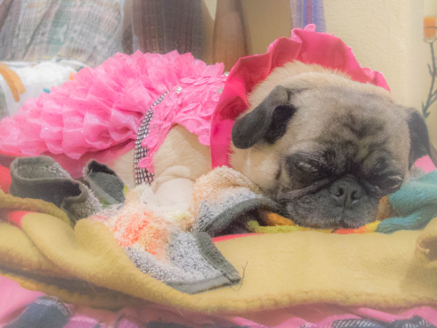
Technically, the AirBnB was run by a friendly lady who welcomed us warmly into her lovely colonial home. Giving us somewhere cozy and dry to escape the rainy afternoons. But it is pretty clear that Mona ran the show.

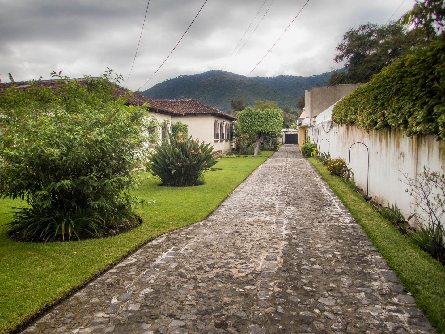
Other times we stayed in various hotels and hostels, or camped in a local park. All of these were amazing. Sometimes because of the wonderful, welcoming people who ran them. Sometimes, the vibrant atmosphere, the colonial charm or simply because ‘hot showers’.

See also  How we ended up not really giving the Pacific coast much of a chance

But none of these were run by such a memorable host as snuffly, gruffly Mona.

Indoor car parking is another thing we like about hotels in colonial towns. Convenient.

We had finally reached the conclusion that we were never going to actually see these oft mentioned, never visible volcanoes. On one of the clearer days we made our way up to the viewpoint at Cerro de la Cruz for a vista across the town towards Volcán de Agua.

That counts. It counts. I can see most of the volcano!

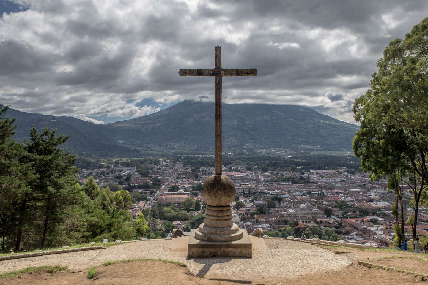
50% volcano, 50% cloud. Still a spectacular view.

We decided it was finally time to climb a volcano. But that is a story for another day. Suffice it to say that cloud, rain and wintery weather was involved. We had all but given up hope of ever seeing these mythical mountains. We were making plans to continue to El Salvador.

Then one morning this happened…

Wait—that is huge—and really close to town! Amazing!

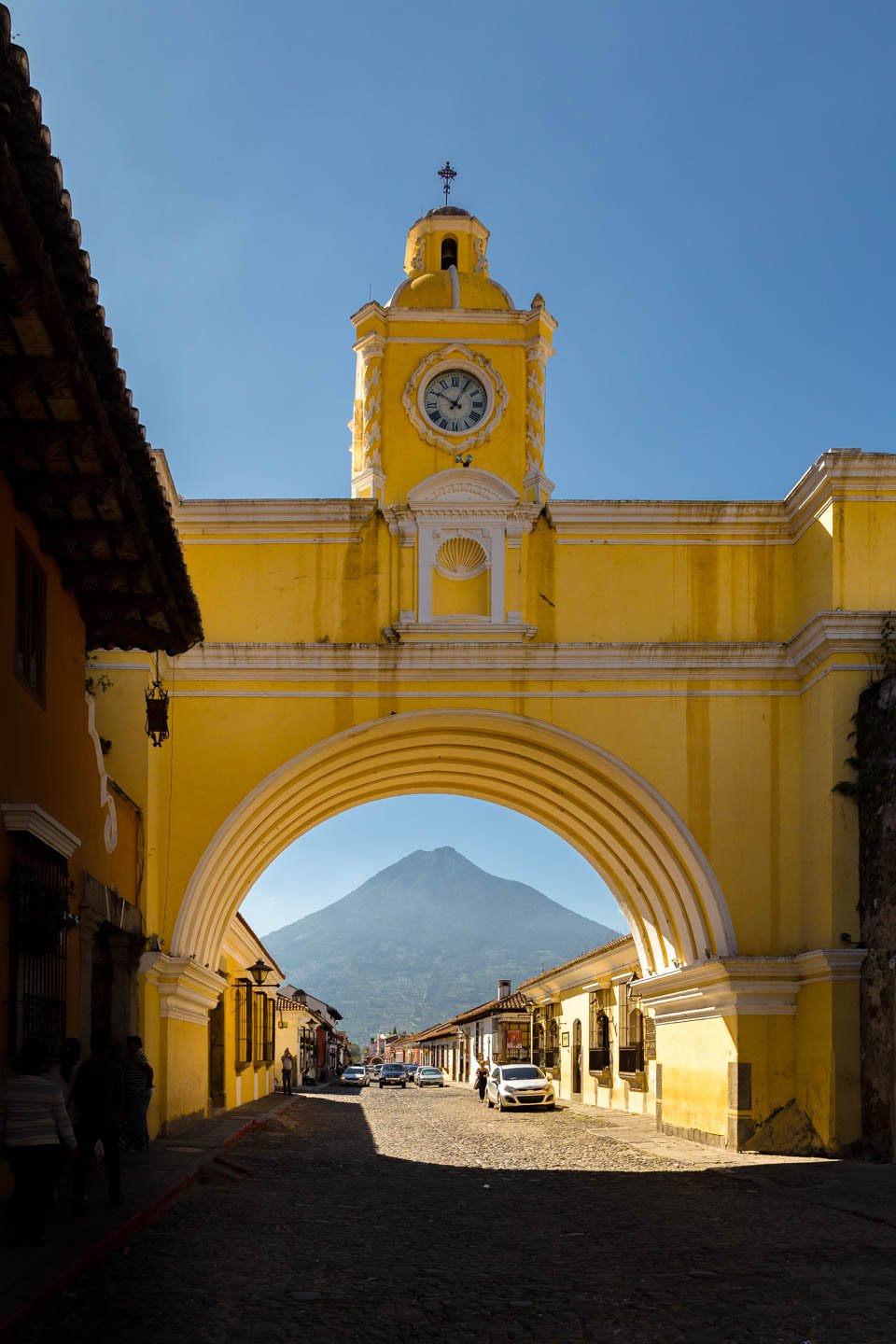
Everyone who visits Antigua seems to have a photo of Volcán de Agua peeking through Santa Catalina Arch. So it seemed wrong to miss the opportunity.

img_3580

We also seized our chance to revisit Cerro de la Cruz to take in the spectacular vista from above the town.

img_3566
Magic.

But was it worth the wait? Absolutely! We’d wait another two months in Antigua. Sipping coffee and nibbling on delicious cheese. We’d do that even if the skies never cleared.

AntiguacloudfoodGuatemalarainstormvolcano
Related Posts

Roasting marshmallows in a volcanic wasteland

18th April 2017
0
0

There’s nothing like a freshly roasted campfire marshmallow.

But does it taste any better if it has been cooked in the heat radiating from the depths of the liquid interior of the earth itself?

This seems like a question that needs to be investigated further.

(more…)
See also  Finally. Guatemala.

Not quite Guatemala—Part 1

24th September 2016
0
0

There was one time, way back in Belize when we were very nearly in Guatemala.

Top notch security on the Guatemalan border. It sure keeps out those pesky tourists.

Location: El Pilar ruins, Belize. Distance to Guatemala: 615.18 m (2018.32 ft)

But ultimately we decided not to go, and returned to Mexico instead.

We then of course faffed about for quite some time in Mexico. So long in fact that many of the friends we thought we would see again in Guatemala were, by this time, in Costa Rica, Panama, and even South America. Whoops.

The rumour going around was that we were going to apply for Mexican citizenship. The thought did cross our minds. We love Mexico. But seriously. It was time to burn some rubber and leave Mexico in our dust. Sort of.

Maybe after a detour around the Mexico/Guatemala border.

From San Cristóbal, it would have been possible to drive directly to the La Mesilla border crossing and be in Guatemala the same day. It would have been a 175 km (108 mi) drive. We could have breakfasted in Mexico and enjoyed dinner in Guatemala.

Nope. Too easy.
Nope. Too easy.

Instead we opted for the smaller, quieter border crossing at El Ceibo. Which meant we might as well drive back through Palenque. The road between San Cristóbal and Palenque is famous for road blocks. But it sounded like the protesters would open the road each day in the mid afternoon if you waited patiently, so even with the delay, the 219 km (136 mi) journey to Palenque sounded pretty manageable.

Too straightforward.

Instead, we opted for an elaborate detour around the Mexico/Guatemala border with time to partake in some sightseeing en route. No rush… right?

Just right.
Just right.

Location: San Cristóbal de Las Casas. Distance to Guatemala: (as the crow flies) 121.58 km (75.54 mi)

IMG_9409

First stop, a rock arch in a nature reserve just out of San Cristóbal.

See also  Two rather interesting hills

Location: El Arcotete. Distance to Guatemala: 120.15 km (74.66 mi)

We don’t want to drive too far in one go, now do we?

Next up. A recreation park featuring some caves, just down the road.

Location: Rancho Nuevo caves. Distance to Guatemala: 112.62 km (69.98 mi)

Time to make some serious progress towards Guatemala… oh look—a waterfall!

Location: Cascadas El Chiflón. Distance to Guatemala: 56.76 km (35.27 mi)

img_9590

Now we’re seriously closing in on the border.

Location: Lagunas de Montebello. Distance to Guatemala: 3.82 km (2.38 mi)

The weather was a bit bleak when we first arrived at Lagunas de Montebello

If we camp really close to the border, does that count as visiting Guatemala?

Location: Lago Tziscao. Distance to Guatemala: 1.02 km (3,332 feet)

Either way it’s a great spot to watch sunrise.

img_9693-pano-edit

(You can see a larger panorama in more detail in our full screen panorama gallery)

Then there was that time we did go to Guatemala, but didn’t get our passports stamped.

Location: Lago internacional. Distance to Guatemala: 0km

From there we can only drive further from the border… or go back and get our passports stamped. We of course, drove further from the border.

At first, only a short distance to take a look at Lago Pojoj.

Location: Lago Pojoj. Distance to Guatemala: 3.19 km (1.98 mi)

You can see this panorama a bit larger in our gallery as well.

img_9751-pano

Then we drove a bit further away.

Location: Las Nubes. Distance to Guatemala: 13.86 km (8.61 mi)

Our favourite thing about this spot? The nice peaceful swimming hole located just at the top of this set of churning, crushing falls that eventually disappear into a rocky gorge and emerge hundreds of metres below in a valley. Way to make health and safety very much optional Mexico.

See also  Not quite Guatemala—Part 2

Anyway. Onward and… further again from Guatemala. We wanted to explore the jungle, but were too cheap to pay for the boat trip. So we looked at the captive Scarlet Macaws and played about on the grounds of the luxury eco hotel that we were equally to cheap to stay at.

Location: Las Guacamayas. Distance to Guatemala: 20.09 km (12.49 mi)

The next stop on our itinerary tiki-touring around the Mexico-Guatemala border was the mysterious Yaxchilan ruins.

But, since we took such a long detour on route to Guatemala, it is probably best if you read about that in our second instalment of ‘Not quite in Guatemala’. Stay tuned…

1 Comment
    Rhonda says: Reply
    May 28th 2017, 7:58 pm

    Great photos as always. I can’t wait to get back to Guatemala and check out Antigua.

Leave a Reply Cancel reply

Your email address will not be published. Required fields are marked *

Newsletter Signup

Categories

  • Australia
  • Beer
  • Belize
  • Bolivia
  • Budgeting
  • Canada
  • Central America
  • Cook Islands
  • Cuba
  • CVT tent
  • Digital Nomad
  • Ecuador
  • Featured
  • Gear Reviews
  • Guatemala
  • Hiking
  • Humour
  • Kaylee
  • Mexico
  • New Zealand
  • North America
  • Oxfam Trailwalker
  • Peru
  • Photo Friday
  • Planning
  • Smoke Chaser
  • South America
  • South East Asia
  • Statistics
  • Travel
  • Uncategorized
  • United States
  • Upgrades
  • Vehicle
  • Video
Roasting marshmallows in a volcanic wastelandby flightlesskiwi / April 18, 2017
If at first you don't succeedby flightlesskiwi / May 20, 2017

Stay In Touch

Subscribe for the latest updates.

Instagram

© 2020 FlightlessKiwis . All rights reserved.

  • Home
  • About
  • Blog
  • Contact
  • Privacy

Recent Posts

  • On the road to ruin (s)
    by flightlesskiwi / 12th October 2015
  • Digital nomads
    by flightlesskiwi / 21st April 2015
  • Why we left too soon for the April Sun in Cuba
    by flightlesskiwi / 3rd September 2015

Looking four our old blog?

We’ve archived our stories and photos from our three year road trip from Deadhorse, Alaska, USA to Ushuaia, Tierra del Fuego Argentina here:

PANAM BLOG

Smoke Chaser logo
Flightless Kiwis logo