IPhone LogoIPad LogoLight Logo
  • Home
  • Blog
  • About
  • Contact
Mexico North America
by flightlesskiwi

Finally, not getting lost. Just relaxing.

9th May 2015
1
0
Share

After all the mapless back-road adventures in the Copper Canyon, we decided it was time to stick to the main roads.

Until we realised how much shorter it was to drive between El Fuerte and Álamos on the back roads.

As usual, Javier (Our ill-informed GPS) failed us in this endeavour. We initially tried to use Google Maps to aid us, but even this let us down when Emma’ s phone had a complete meltdown. After a quick stop to ask a local rancher for directions, we were back on track. Who needs maps anyway?

We liked that the fords on the road were labelled with these helpful posts.

Which for those unsure of the Spanish, from the bottom up reads:

White: “Everyone is sweet as”

Green: “Maybe you should have a truck”

Red: “Abandon all hope ye who enter here”

Due to the complete lack of rain in the area we had no trouble navigating the rest of the way to Álamos. Looks like we’d vastly improved our navigation skills after the Copper Canyon debacle.

Like El Fuerte, Álamos is another of Mexico’s Pueblos Magicos. 

Álamos started life as a silver mining boom town. By the late 18th century it was the biggest producer of silver in the world, the town continued to flourish throughout much of the following century.

In the early 20th century however, the mines closed, the wealth dried up and the people moved away. Álamos was all but abandoned, from a population of up to 30,000 to fewer than 1000. The town fell into disrepair, formerly lavish buildings were forgotten and left to rot. 

Abandoned archway, Álamos, Sonora, Mexico.
The remnants of a forgotten building.

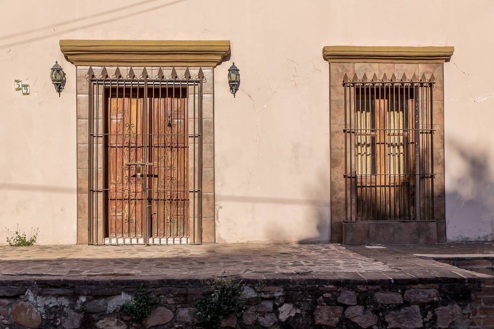
Over time an enthusiastic expat community from the USA (who appear to be mostly snowbirds and retirees) have been buying up the abandoned homes and restoring them to their former colonial glory. 

This street looks a little more glamorous.

This influx of residents from the United States combined with the already established local community creates an interesting town atmosphere. Sometimes it felt like being in Mexico, sometimes it felt more like being in the USA.

See also  Mexico

We had lunch at a delightfully cheap tamale stand attached to a butcher’s market of questionable hygiene standards (both the butchers and the tamale stand). Here, the meal cost a few pesos and was accompanied by some thermonuclear home-made hot sauce. We only conversed with the stand’s owner in Spanish and left feeling full, with our wallet no lighter for our troubles.  

The following day, we sampled a comparatively expensive restaurant with dainty pastries, glistening silverware, freshly brewed espresso and assorted salads. This was served in the elaborate courtyard of a refurbished colonial home. All conversations with the restaurant’s owner were in English and we left with our wallets significantly lighter. 

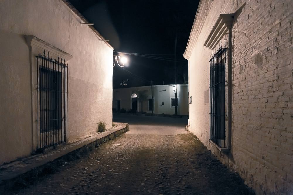
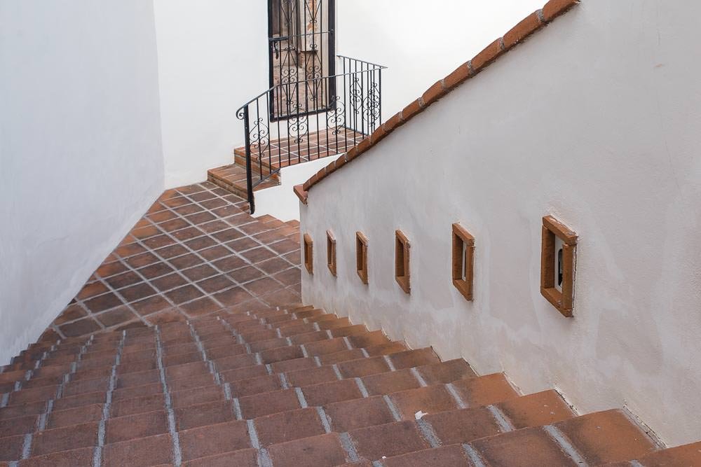
Much as we had done in El Fuerte, we spent our time in Álamos wandering the peaceful cobblestone streets and photographing the irresistible colonial architecture. There wasn’t a lot more to do in this peaceful town. Just eat, sleep, relax and enjoy. 

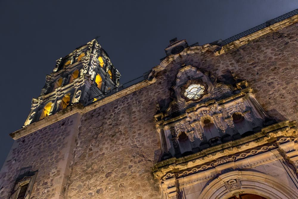
Like El Fuerte there was a verdant central plaza, this time with a slightly grander church, which was undergoing restoration work when we visited.

We were camped in a peaceful spot, just on the edge of town. Which we managed to find by following the directions ‘just next to the cemetery’. Spooky.

Luckily, not the view from the camp site.

Conveniently, the campground was rather pleasant, there was even a swimming pool.

Love when we find one of these at a campground.

A friendly dog.

Even better when there is one of these.

And an adorable kitten.

Nobody can resist little Milus.

So we already felt pretty at home.

The local campground residents (snowbirds down from the USA) were very welcoming, introducing us to their local friends who were at various stages on renovating properties and telling us more about the area. We ended up crashing one of their evening shindigs around a campfire. Bearing in mind that all of these people were of retirement age (plus a fair bit in some cases) we were a little out of place on the age front, but enjoyed an evening of their tales of adventure and good food and beer. Although perhaps found it a little harder to identify with any discussions regarding pensions, loopholes in the health care system or town meetings. We’re confident that if we are continuing to enjoy life as much as these retirees were, then we will be doing something right.

See also  Nevada, not just aliens and neon lights

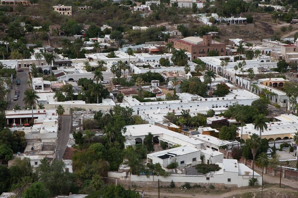
There was a mirador that provided panoramic views of the city, worth walking the 373 or so steps for the view. The views were equally pretty both day and night.

In fact the whole town was equally pretty whether viewed by day or night.

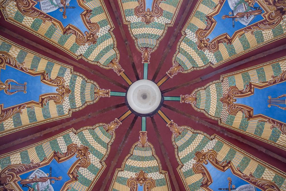
We took a tour with a local history expert who guided us around the centre of town explaining the history of the area and the influence it had had on the architecture. He also guided us through the lavish interiors of a few of the colonial buildings.

Plus there were the obligatory visits to arts and craft sellers…

The town was preparing for an influx of visitors in a little over week for the annual Dr. Alfonso Ortiz Tirado Cultural Festival. This music festival is held in honour of the Álamos born doctor who also happens to be Mexico’s most famous tenor. It sounded like the festival was going to be a big deal with many thousands of people due to be arriving from around the world. We were tempted to stay and check out the festival, and we probably should have—but after a few days of rest and relaxation we were itching to continue our journey. Besides. It was probably time to get into some more trouble, if we could find it.
ÁlamosarchitecturebuildingscolonialfoodhistoryMexicoPueblo MagicorelaxingSonoratown
Related Posts

Four days on a beach

7th April 2015
2
0

As usual, we had hit the road without much of a plan.

People we had spoken to had suggested several great places near to Loreto which sounded like fantastic next destinations. However, hindered by our near complete lack of maps, Agua Verde was simply the place on that list that we accidentally stumbled upon next.

(more…)
See also  Tlaxcala

Not quite Guatemala—Part 1

24th September 2016
0
0

There was one time, way back in Belize when we were very nearly in Guatemala.

Top notch security on the Guatemalan border. It sure keeps out those pesky tourists.

Location: El Pilar ruins, Belize. Distance to Guatemala: 615.18 m (2018.32 ft)

But ultimately we decided not to go, and returned to Mexico instead.

We then of course faffed about for quite some time in Mexico. So long in fact that many of the friends we thought we would see again in Guatemala were, by this time, in Costa Rica, Panama, and even South America. Whoops.

The rumour going around was that we were going to apply for Mexican citizenship. The thought did cross our minds. We love Mexico. But seriously. It was time to burn some rubber and leave Mexico in our dust. Sort of.

Maybe after a detour around the Mexico/Guatemala border.

From San Cristóbal, it would have been possible to drive directly to the La Mesilla border crossing and be in Guatemala the same day. It would have been a 175 km (108 mi) drive. We could have breakfasted in Mexico and enjoyed dinner in Guatemala.

Nope. Too easy.
Nope. Too easy.

Instead we opted for the smaller, quieter border crossing at El Ceibo. Which meant we might as well drive back through Palenque. The road between San Cristóbal and Palenque is famous for road blocks. But it sounded like the protesters would open the road each day in the mid afternoon if you waited patiently, so even with the delay, the 219 km (136 mi) journey to Palenque sounded pretty manageable.

Too straightforward.

Instead, we opted for an elaborate detour around the Mexico/Guatemala border with time to partake in some sightseeing en route. No rush… right?

Just right.
Just right.

Location: San Cristóbal de Las Casas. Distance to Guatemala: (as the crow flies) 121.58 km (75.54 mi)

IMG_9409

First stop, a rock arch in a nature reserve just out of San Cristóbal.

See also  A small bite of the Big Apple

Location: El Arcotete. Distance to Guatemala: 120.15 km (74.66 mi)

We don’t want to drive too far in one go, now do we?

Next up. A recreation park featuring some caves, just down the road.

Location: Rancho Nuevo caves. Distance to Guatemala: 112.62 km (69.98 mi)

Time to make some serious progress towards Guatemala… oh look—a waterfall!

Location: Cascadas El Chiflón. Distance to Guatemala: 56.76 km (35.27 mi)

img_9590

Now we’re seriously closing in on the border.

Location: Lagunas de Montebello. Distance to Guatemala: 3.82 km (2.38 mi)

The weather was a bit bleak when we first arrived at Lagunas de Montebello

If we camp really close to the border, does that count as visiting Guatemala?

Location: Lago Tziscao. Distance to Guatemala: 1.02 km (3,332 feet)

Either way it’s a great spot to watch sunrise.

img_9693-pano-edit

(You can see a larger panorama in more detail in our full screen panorama gallery)

Then there was that time we did go to Guatemala, but didn’t get our passports stamped.

Location: Lago internacional. Distance to Guatemala: 0km

From there we can only drive further from the border… or go back and get our passports stamped. We of course, drove further from the border.

At first, only a short distance to take a look at Lago Pojoj.

Location: Lago Pojoj. Distance to Guatemala: 3.19 km (1.98 mi)

You can see this panorama a bit larger in our gallery as well.

img_9751-pano

Then we drove a bit further away.

Location: Las Nubes. Distance to Guatemala: 13.86 km (8.61 mi)

Our favourite thing about this spot? The nice peaceful swimming hole located just at the top of this set of churning, crushing falls that eventually disappear into a rocky gorge and emerge hundreds of metres below in a valley. Way to make health and safety very much optional Mexico.

See also  Tiwanaku (Tiahuanaco)

Anyway. Onward and… further again from Guatemala. We wanted to explore the jungle, but were too cheap to pay for the boat trip. So we looked at the captive Scarlet Macaws and played about on the grounds of the luxury eco hotel that we were equally to cheap to stay at.

Location: Las Guacamayas. Distance to Guatemala: 20.09 km (12.49 mi)

The next stop on our itinerary tiki-touring around the Mexico-Guatemala border was the mysterious Yaxchilan ruins.

But, since we took such a long detour on route to Guatemala, it is probably best if you read about that in our second instalment of ‘Not quite in Guatemala’. Stay tuned…

1 Comment
    Heading south again—for a change | Flightless Kiwis says: Reply
    May 18th 2015, 4:00 am

    […] wore us down because we had enjoyed such a peaceful, relaxing time in El Fuerte and Álamos. These towns had all the charm that Mazatlán had promised with none of the hassle. Sure they […]

Leave a Reply Cancel reply

Your email address will not be published. Required fields are marked *

Newsletter Signup

Categories

  • Australia
  • Beer
  • Belize
  • Bolivia
  • Budgeting
  • Canada
  • Central America
  • Cook Islands
  • Cuba
  • CVT tent
  • Digital Nomad
  • Ecuador
  • Featured
  • Gear Reviews
  • Guatemala
  • Hiking
  • Humour
  • Kaylee
  • Mexico
  • New Zealand
  • North America
  • Oxfam Trailwalker
  • Peru
  • Photo Friday
  • Planning
  • Smoke Chaser
  • South America
  • South East Asia
  • Statistics
  • Travel
  • Uncategorized
  • United States
  • Upgrades
  • Vehicle
  • Video
The Copper Canyon with questionable maps. Part three.by flightlesskiwi / May 3, 2015
365 Days on the Roadby flightlesskiwi / May 11, 2015

Stay In Touch

Subscribe for the latest updates.

Instagram

© 2020 FlightlessKiwis . All rights reserved.

  • Home
  • About
  • Blog
  • Contact
  • Privacy

Recent Posts

  • On the road to ruin (s)
    by flightlesskiwi / 12th October 2015
  • Digital nomads
    by flightlesskiwi / 21st April 2015
  • Why we left too soon for the April Sun in Cuba
    by flightlesskiwi / 3rd September 2015

Looking four our old blog?

We’ve archived our stories and photos from our three year road trip from Deadhorse, Alaska, USA to Ushuaia, Tierra del Fuego Argentina here:

PANAM BLOG

Smoke Chaser logo
Flightless Kiwis logo