The distance on the map didn’t look to be that far. Really, kilometre-wise it wasn’t. But how long it takes to get there can depend on which roads you drive on.
We didn’t have a map of Guatemala. Just a few roads outlined roughly on a back page of our belatedly purchased Mexico map book. That’ll do the trick, right?
Wrong.
Our cross-country road trip was off to a bumpy (literally) start.
We followed a detour to see some hot-spring waterfalls. Rainy season is not the best time of year to drive a few hundred kilometers out of your way for this sort of thing. We never even made it to the falls. After setting up camp nearby, the locals warned us it was flooded, muddy and miserable.
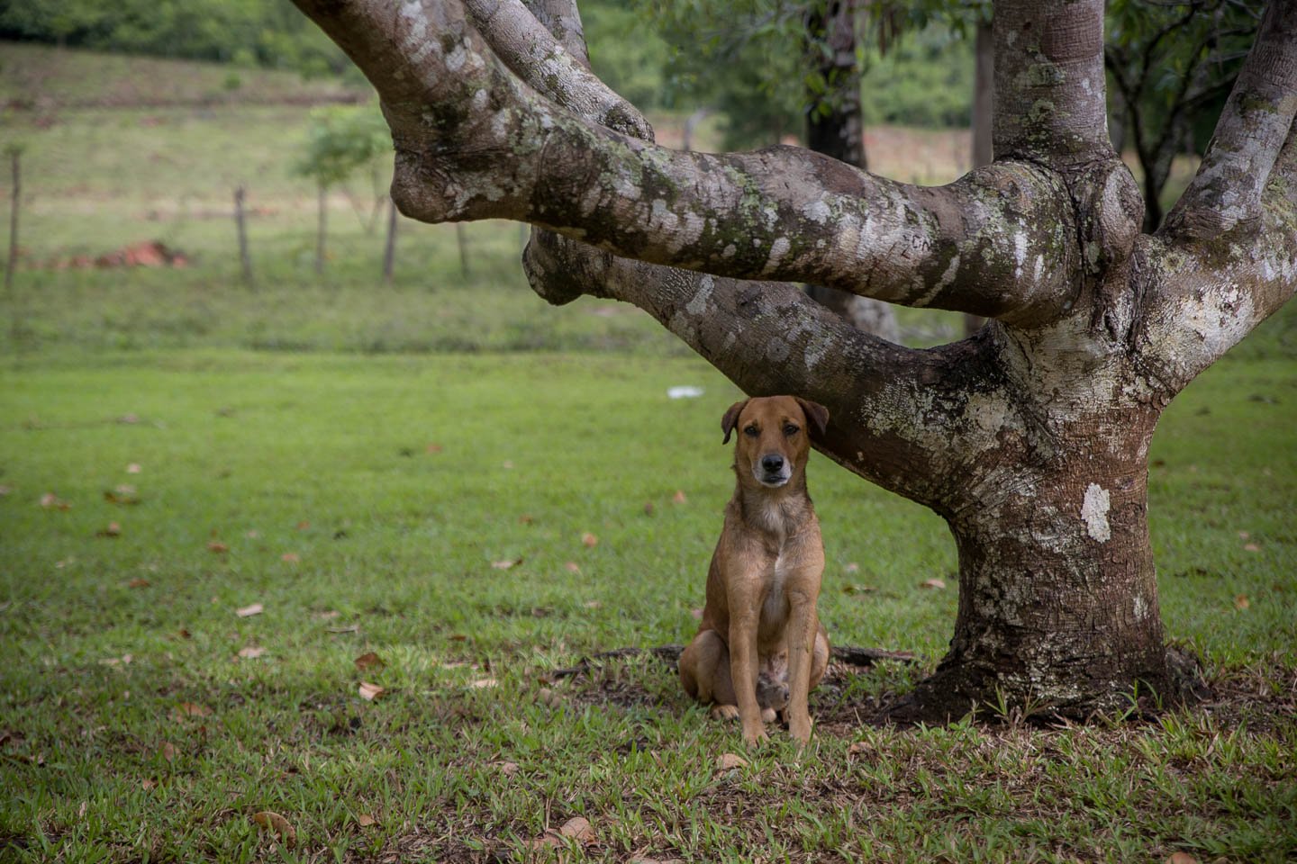
So instead, here’s a photo of a dog.
From that failed detour we had already left the obvious cross-country route. So it seemed logical to find a new, more direct route from where we had ended up. We followed one of the many vaguely outlined roads on our ‘map’. It stretched from the waterfall we didn’t visit all the way to Lago Atitlán, our next destination. It was where we planned to study Spanish in coming weeks.
This route seemed like a better plan than back tracking to the main road we had turned off to get there.
Also wrong.
Not only were we winding up and down mountain ranges. But we were following what was often a rather narrow and dusty road for one marked as a main highway on the map.
Also, it just so happened that it was election day in Guatemala.
This meant a very slow roll through every single small town or village. Each town was packed to the brim with no space to drive. Markets, trucks piled high with voters, milling crowds, scooters and cars filled the roads.


Ultimately, it took a few days to make what we thought was supposed to be a day’s drive.
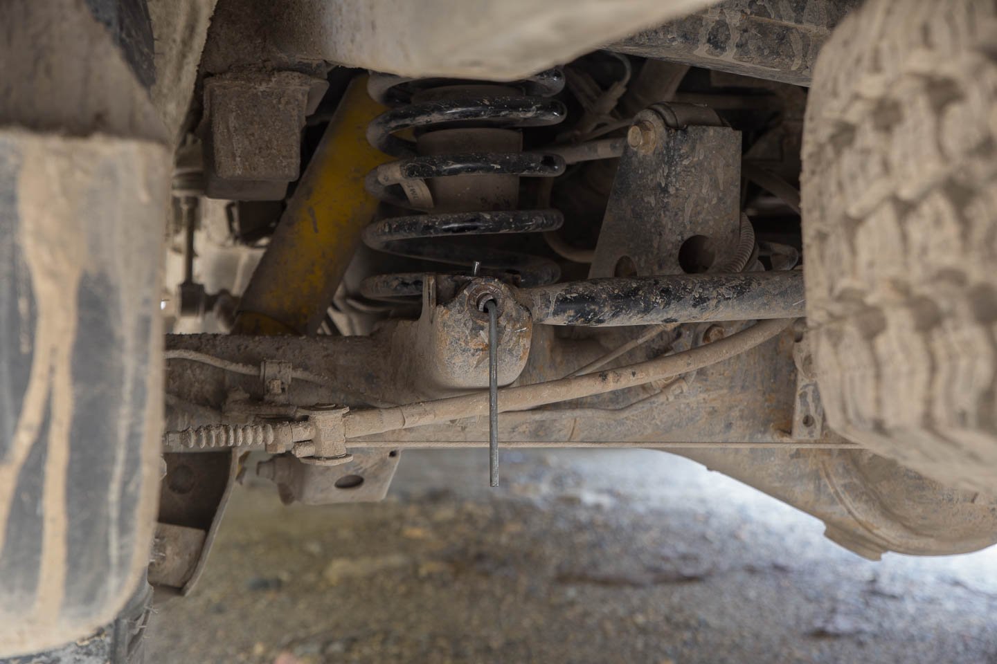
It didn’t help that as we were rolling down the road we heard an almighty thumping ‘something-isn’t-quite-right-under-the-4Runner’ noise.
There was no longer a bolt holding the panhard bar in place.
Whoops.
Good news though: A tent peg does the trick in a pinch.
Onwards to Lago Atitlán.
The closer we got to the lake, the nicer the roads became. Soon we were rolling down a multi-lane highway with not a pothole in sight. We realised we must have finally strayed onto the official PanAm highway.
From the outset of our travels we had claimed our plan was to drive this highway. It wasn’t actually until this point that we were sure we were actually on the ‘official’ PanAm route. Otherwise we had spent the majority of our time taking detours and side trips.
Speaking of which. Lago Atitlán is one such side trip we did not want to miss—quick! Leave the PanAm!
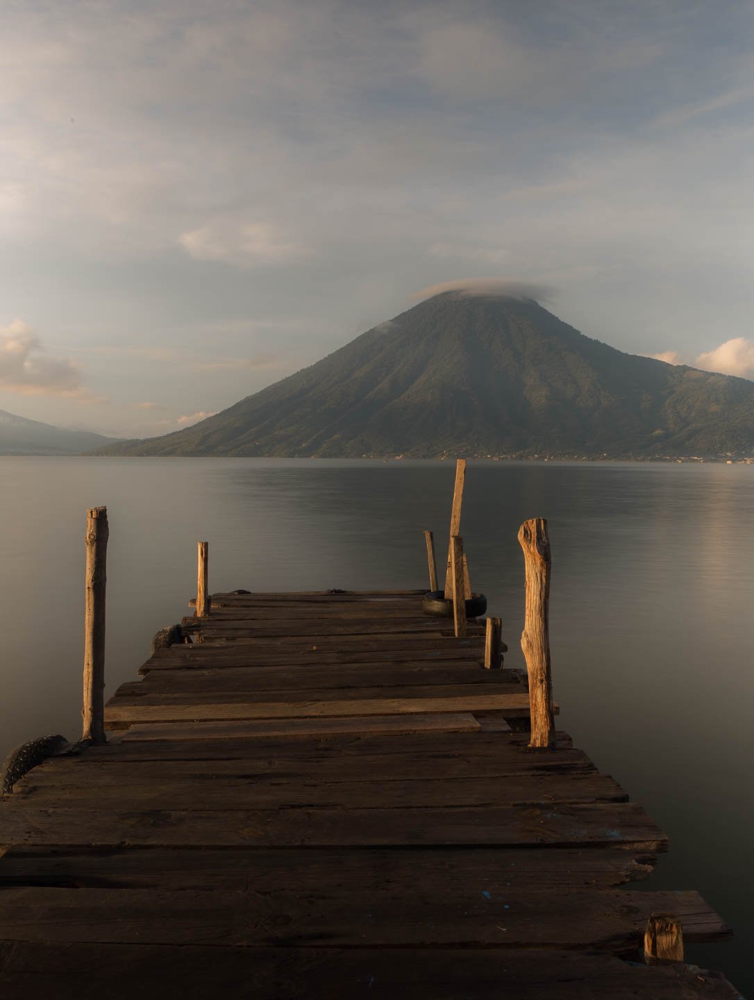
Atitlán is a lake formed in the caldera of an ancient volcano. The deepest lake in Central America (340m). There are three volcanoes that stand like sentinels along it’s shores: Volcanes San Pedro, Tolimán and Atitlán.
The roads around the lake are notorious for being slow to drive. They weren’t anywhere near as bad as some might make them out to be. The boat network connecting the lakeside villages was far more efficient than any road. There were official jetties at each town. It was possible to flag down a passing passenger boat from any of the private jetties if you wanted a ride into town. Convenient.


It has been said that Lago Atitlán is the most beautiful lake in the world. We don’t want to jump to any rash conclusions, since we haven’t seen them all yet. But yeah. It’s pretty.
We planned to study Spanish for at least a few weeks in San Pedro de La Laguna. A bustling backpacker town on the shores of Lago Atitlán. But before embracing the bustling town, it was time to relax. First stop, San Marcos, a small, quiet village, a short distance (by boat) from SanPedro.
Our camp site was verging on perfect. Just out of town, with views of volcanoes and thunderstorms. Like watching a live nature documentary from our ridiculously impractical camping chairs.
We were regularly visited by the owner’s pack of lovable German Shepherds. The caretaker’s friendly dog practically lived at our campsite.
There were plenty of other campsite visitors, mostly of the critter variety.
You know you’ve been on the road a while when you are sharing a shower cubicle with five large spiders and there’s a dead scorpion in the sink, but all you can think is “This has to be the best shower I’ve had in a month!”.
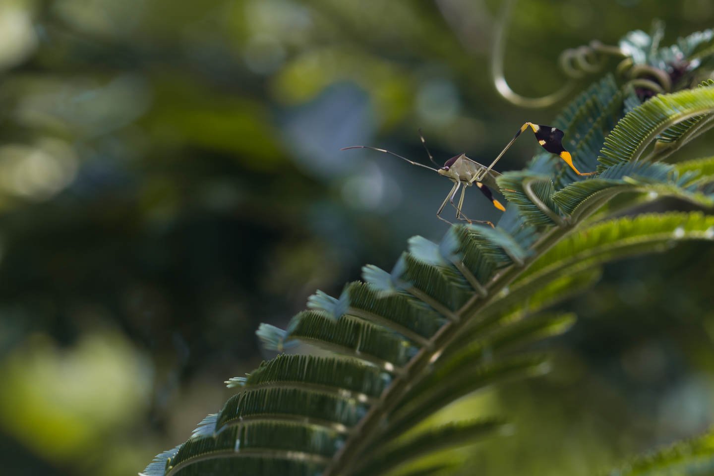
Not all critters were of the spidery-scorpiony variety either.
Like this guy:

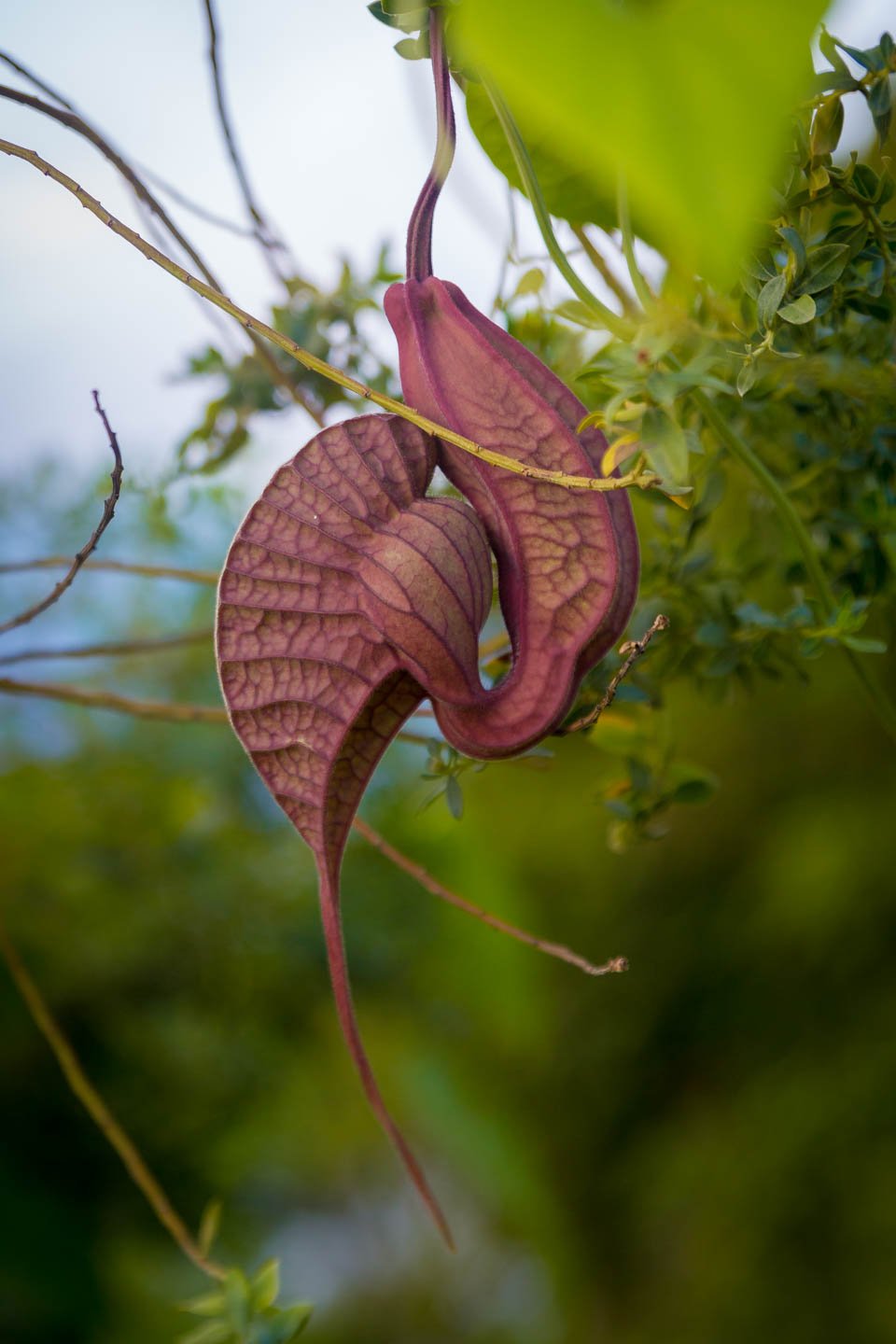
Even this flower is rather cool. Initially we thought it must be some kind of terrifying carnivorous plant of doom. It smells like off meat, looks like it could eat a small child and hangs there in a menacing fashion.
Instead, this Pelican Flower traps bugs, holds them prisoner for the day, rolls them in pollen and then releases them back into the wild.
Ain’t nature grand!
The booming gringo population in the area meant that there were all sorts of goodies available in the stores. Cheeses, craft beer, delicious muesli, freshly made tahini paste, locally sourced cacao energy bars. Clearly, Lago Atitlán was going to be delicious.
Stunning lakeside sunrises, delicious food, relaxing atmosphere, reliable campsite guard dog and hot showers. Did we even want to go to San Pedro to study Spanish? It was tempting just to stay right here.











4 Comments
While, somehow I didn’t remember that you had actually camped here but yea, pretty cool!
We hope to head back one day 🙂
[…] popular spot in Guatemala that we had missed on our very first cross Guatemala road trip was Semuc […]
[…] our previous cross-Guatemala drive had us winding slowly through mountainous back roads. We decided to follow the recommended […]