So, where do you plan on going?
Um. From Deadhorse, Alaska to Ushuaia, Argentina…
At some point it becomes necessary to pad out the details between those two places. We feel that the time to do that will probably be when we are already on the road.

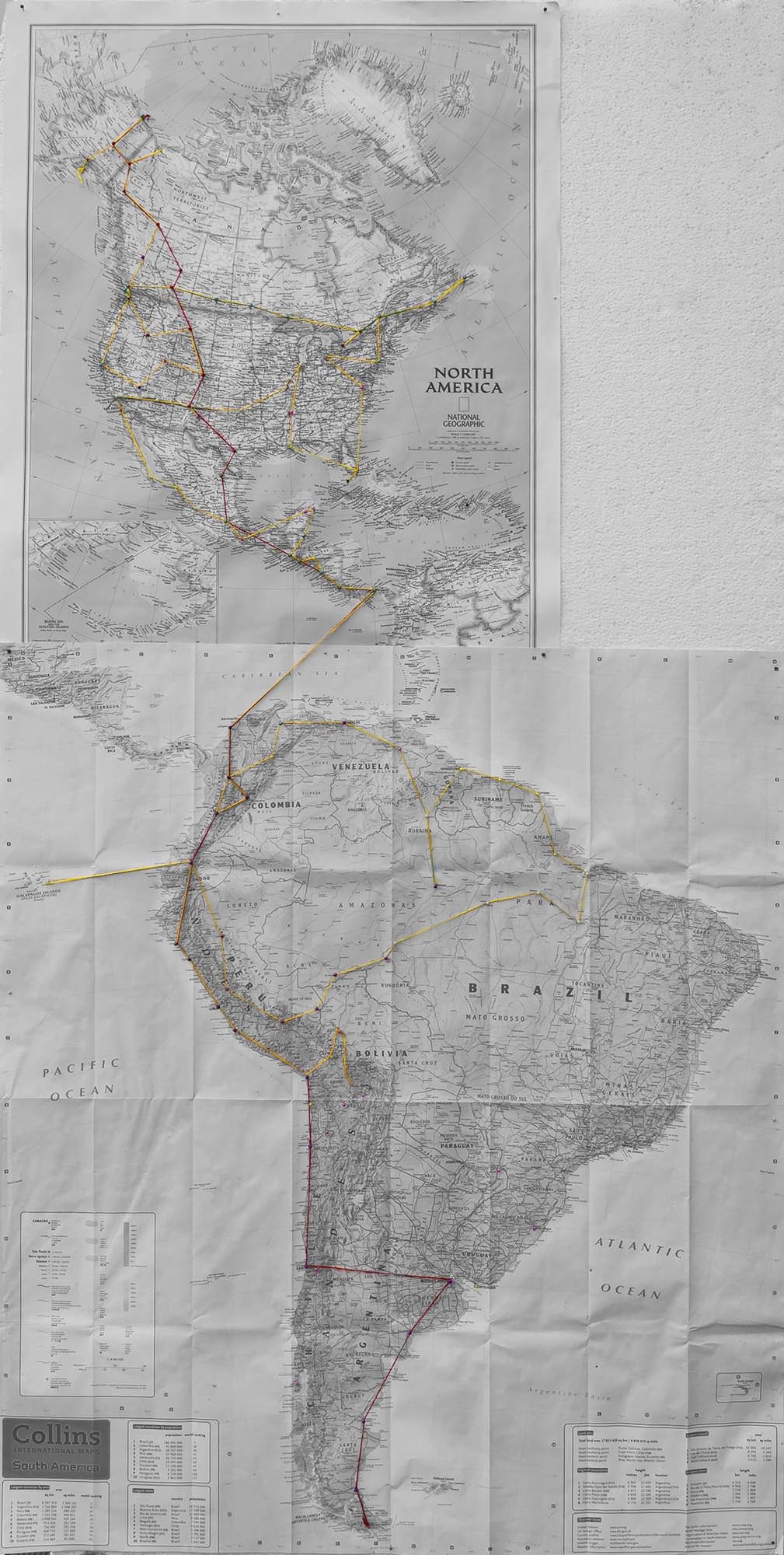
However, not wanting to be completely without a plan we popped a paper map up on some polystyrene in the lounge. Mostly, this served as an inspirational reminder of what we were saving for. Also as a reminder of the difficulty in finding a map of North and South America printed to exactly the same scale. But we feel that our attempt was close enough.
After spending quite some time sitting against the wall of our lounge with a pin at each end of the road trip, the map was feeling a little neglected.
Cue adding some red string to denote the official (and not-so official, but close enough) route of the Pan-American Highway.
Somehow this didn’t seem to cut the mustard on the planning front.
Chasing up the red string with some green string to denote the Trans-Canada highway and Route 66 seemed like a bit of a lazy attempt at planning as well.
So out came the yellow string and something that more closely resembled a route plan.
Starting in Anchorage, driving to Deadhorse. Heading back South to Canada (with a detour along the Dempster Highway to Inuvik). Then a bit of general looping around the US and Canada before heading further south through Mexico. Next, Central America, which is followed by a quick change of maps (and scale) between Panama and Colombia and we move onward to South America.
This will be followed by a bit of a jaunt through Colombia, Venezuela, the Guianas, a vastly impractical trundle through the Brazilian rainforest. On to Peru, Ecuador (the short loop off to the Galápagos Islands depends on finances and will clearly not be done in our vehicle). Back south through Peru and into the Bolivian Altiplano—where we ran out of string.
That is about where we are at with the trip planning.
We’d like to go to Cuba, Easter Island and Antarctica, but fear that we’ll blow the trip budget on beer and cheese before we even get near any of these places. We don’t really know what the political situation will be in Venezuela when we get there. We can’t say for sure that we’ll have enough money left to do a visit to the Guianas and Brazil and justice.
And quite frankly, we are out of string.
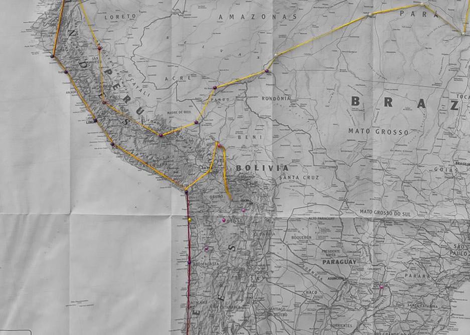
It isn’t that we haven’t been thinking about the places we’d like to go. Emma has hundreds saved and bookmarked on various online accounts, Ben has mentioned a couple of places he’d like to check out. We just haven’t put a lot of thought into how we are going to get to them.
However, we both feel that planning the route as we go and making detours along the way will be the best way forward with this adventure.
In the past we have been on a mix of more regimented trips (where Emma has colour-coded and scheduled nearly every minute of the trip to ensure everything can be done in the shortest, most effective way possible—6am wake up calls included) and much more vaguely planned trips (where we head out the door, not really knowing where we are going or why).
For a trip that we hope will stretch over 18–24 months we feel that the latter is the best plan. Or lack of plan.
So where do you plan on going?
Wherever the road takes us.






2 Comments
I love the string idea! And love that you’re planning on visiting the Guyanas region. So few do that (and we’re thinking we’ll do it after we hit Patagonia and circle back around the continent via Brazil, etc. I try not to think too far in advance because by the time either of us get there Venezuela may have a new president and some other country will be in turmoil… you just need to go with the flow. Looks like a great map to me!
Certainly hoping to visit the Guyanas, budget permitting. (I really need to stop spending our money…) Doing the circle round South America sounds like a good plan though.